27-29 October, 2019
My original plan for this hike was to head to Yamanashi and spend a few of days hiking around and over Mt Zenpu. The aftermath of Typhoon Hagabis put an end to all that though, not only washing away parts of the trail, but also closing the only train line that went through the area. Even a couple of weeks later there were still issues with the trains, so I gave up and looked for somewhere else.
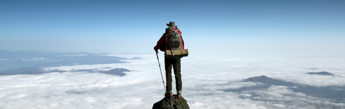
I’ve wanted to head up into the mountains at Hakuba, ever since I saw the craggy black pyramidal top of Mt Shirouma floating in the clouds while snowboarding at Happo. The train service to Hakuba was also disrupted, but the buses were still running, albeit with a bit of a detour. So that was where I headed.
Day 1
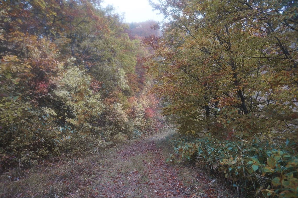
At 6:30am on Sunday morning, I hopped onto a bus at the Shinjuku Bus Terminal, just across the road from the train station. With the detour, the trip took about five and a half hours to reach the Hakuba Happo bus terminal. The weather, as it almost always seemed to be at Hakuba, was gloomy, but the subdued light did bring out the autumn colours along the way. The forecast had been for three perfect, sunny days in the mountains – a rare thing for that area. But right away, as I stepped out into the drizzle, I could see that Mother Nature had other ideas. Clouds obscured pretty much everything. Only the lower ski runs were visible, and those looked grey and uninviting. So I put on my jacket and overpants, invited myself, and headed off for the gondola.
It was the final day of operation for the gondola until the ski season opened. That was another reason I’d chosen to head to Hakuba. Firstly, the lifts would give me an elevation boost of around a thousand meters, and secondly, once they’d closed, I figured that there’d be very few other people headed up. At least, not that way.
There were only one or two other people around, and nearly everything in the town was closed. After an easy ten-minute walk, I reached the gondola ticket booth. There I asked for a one-way ticket for the gondola as well as the two other chairlifts up above it that were still running. The girl inside looked surprised, to say the least. She told me that the gondola closes today so I’d need a two-way ticket. I politely shrugged it off and said I won’t be coming back down today. Then she looked even more surprised. So much so, that she pulled her colleague over, as though to verify what she thought she’d heard me say. The other girl asked me what I was planning, and I told them that I was off for a bit of a romp in the mountains, give or take a few peaks depending on the weather.” They seemed a tad incredulous, and after conferring quickly and quietly for a few seconds, the second girl pushed a hiking plan across the counter and asked me to write down my intended route.
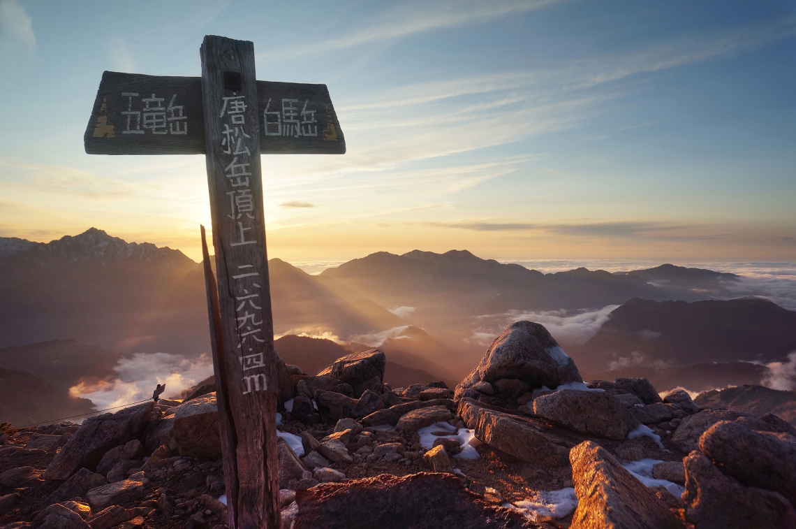
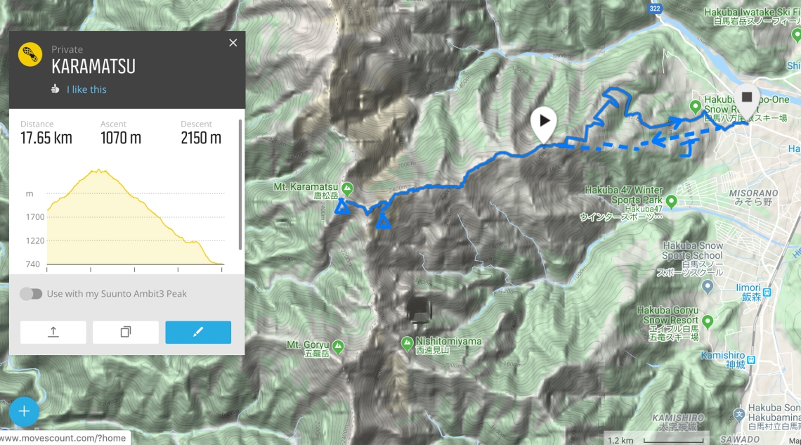
I scrawled a few names down – Karamatsudake, Yarigatake, Shiroumadake, then down to Sarkuwaso and back to Happo. I told them the plan was all dependent on the weather, snow cover, general motivation, angry snow monsters, and slips and tumbles off giant cliffs, and that there was every chance I’d come back down pretty much the same way I was heading up. They told me that the mountain lodges were closed, and asked if I had an emergency tent. I found that term interesting, and pictured myself after a day of hiking; alone in the wilderness, exposed to the elements, without a plan, darkness setting in, having no idea what to do or how I was going to find shelter for the night, then having a lightbulb moment – ah yes! This feels like the sort of situation I could never have foreseen nor prepared for! Luckily, I brought my emergency tent! I told them I did, as well as crampons, food and water for about six days, a map and a GPS, and dozens of mountain mishaps under my belt, and they relaxed a little.
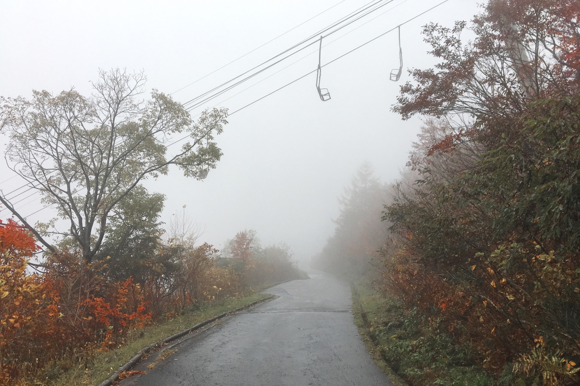
After paying the 1500¥ for a ticket for the three lifts, I headed around to the rear side of the building and gondola entrance. There was nobody around, and the empty gondolas drifting in and out of the mountain mist on their ways up and down the steep slope created a bit of a dreamy scene. Autumn colours surrounded the cable cars like a sea of muted amber and I paused to stare for a minute, a tad taken by the beauty of it all.
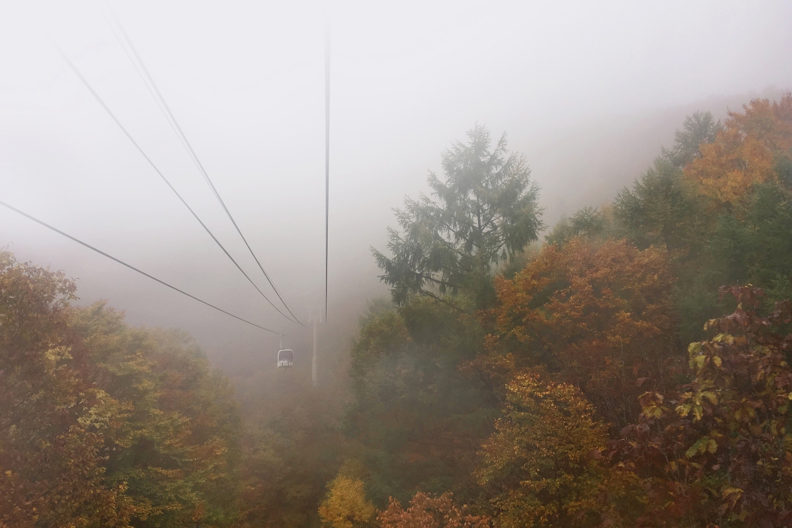
Then it was into the gondola and up. I remember seeing it the last time I was at Hakuba for the snow season, but I’d never paid it all that much attention. It headed up a narrow corridor between two walls of trees, and was steep. The grassy area beneath the gondola cables would be possible to hike back down, but it would be extremely slow going, especially in the wet. Maybe there were other ski runs I could head down. I’d worry about that later. Large drops of rain hit the windows and within a couple of minutes I was in clouds.
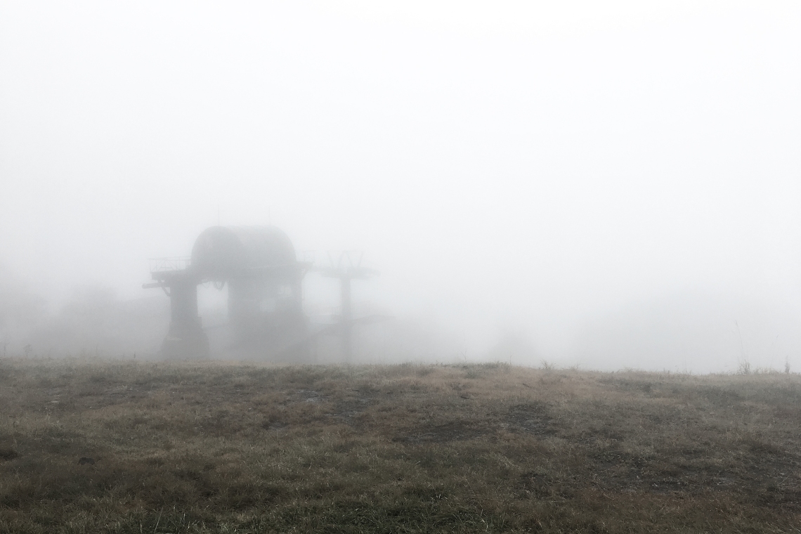
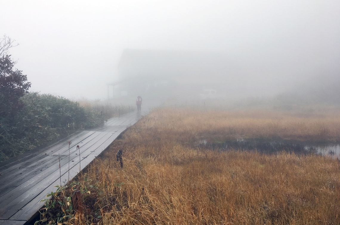
A 10 minute ride carried me up about 600 vertical metres, out onto a plateau area. The drizzle had stopped, and the place was ethereal – a mysterious world concealed by mist. Off in one direction was the grey outline of another chairlift building, looking every bit like something out of Silent Hill.
The first chairlift I had to catch was a short way to the left, and after a couple of photos, I headed that way, walking past a small alpine pond in front of the lift station.
The station was also enshrouded in clouds, and looked picturesque and rustic against the autumnal alpine colours.
 Approaching the first of the high chair lift stations.
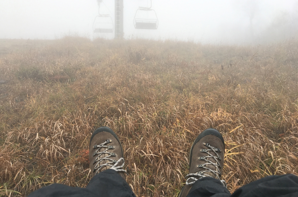
This lift had benches dangling so low that my boots skimmed over the grass at a couple of points. I’m not sure how it works when there’s a metre of snow on the ground, but it made the ride more fun. I gained another 250 vertical metres on this one. Then it was onto the third and final ride, up to the top of the highest Happo ski run. It was another 200 metres of height that I was happy to have skipped. All up, the gondola and lifts made for a saving of just over a thousand vertical metres. On the steep ski runs, that saved me at least five hours of plodding.
It started raining again, a little more heavily this time. I stopped in the shelter of one of the buildings to put on my neck buff and beanie and down a couple of energy goop drinks. As I messed around, a few people passed on their ways back down the mountain path in couples and small groups. There were more people up here than there were wondering around down in Hakuba. Some were in hiking gear, but there were also a few who were dressed like they were on their way to lunch at Ginza. I figured that whatever they’d walked up from the chairlift station to see, couldn’t been too far away. At around 1pm, all water-and wind-proofed up, I heaved on my backpack and headed off.
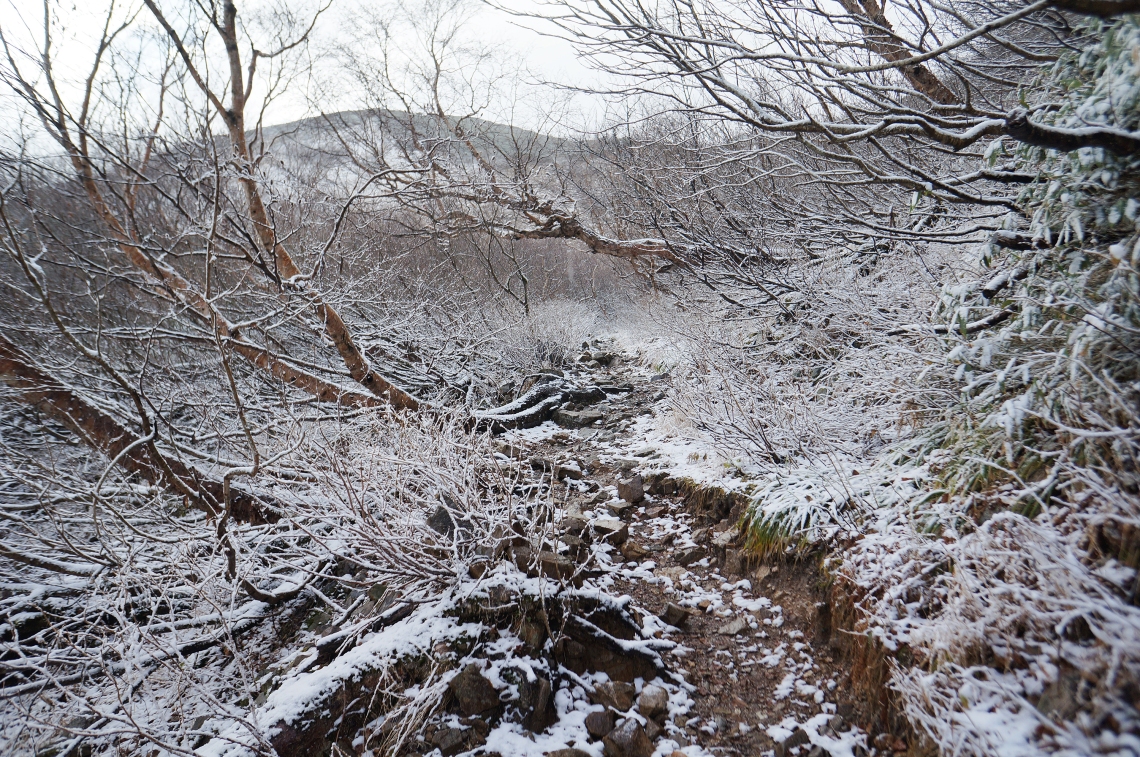
The hike began with a rocky but easy trail that snaked along just below the ridge top. Within minutes, I met with a bubbly, multi-generation family group coming the other way. They were keen to chat and to learn everything from my plans on the mountain, to my favourite food as a child. I described freezing nights in tents and sausage rolls, and after a few minutes of chit-chat we were on our ways.
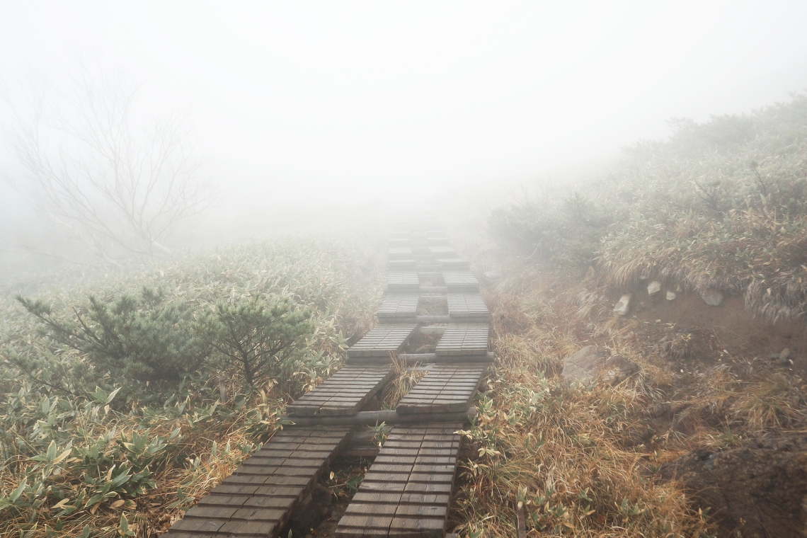
The next people I met were a youngish guy and girl. The guy was dressed in a running singlet and running pants, with a hoodie draped over his shoulders. He said that there was a blizzard going on higher up and warned that it was too cold up there. I was a little lost for words. I said that it sounded like top fun and thanked him for the heads up. The path turned into a raised boardwalk for a little while, occasionally splitting into parallel paths that snaked side by side up into the mist.
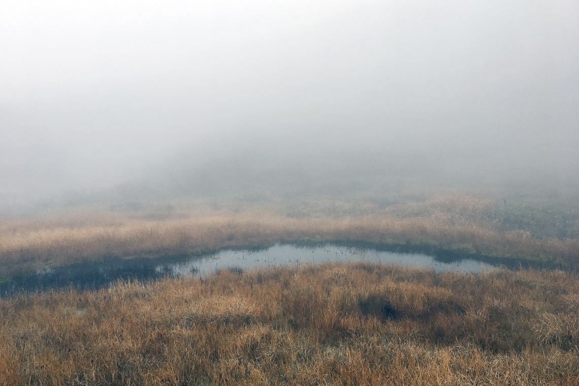
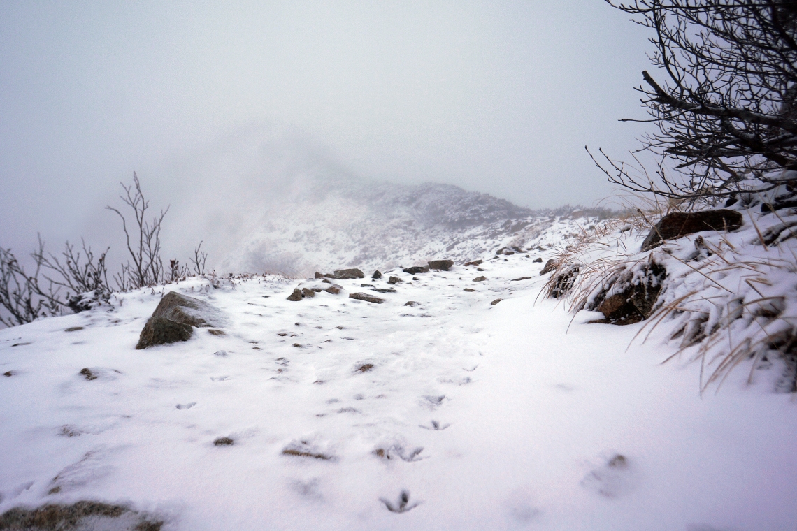
At a quarter to two, after passing over a couple of humps along the ridge, I arrived at a small alpine lake – Happo-ike Pond. It sits in a little depression just off the main ridge, and on a clear day there must be grand views of the pond and mountain range beyond. But this was no clear day and there was no sign of the rocky peaks. Just a uniform grey that drifted about trolling anyone who had hopes for a snippet of a view. The only other people about were at the far side of the pond, huddled together, trying to fix a backpack or something, as a cold wind blew down from the mountain. I took a few photos but didn’t stay long.
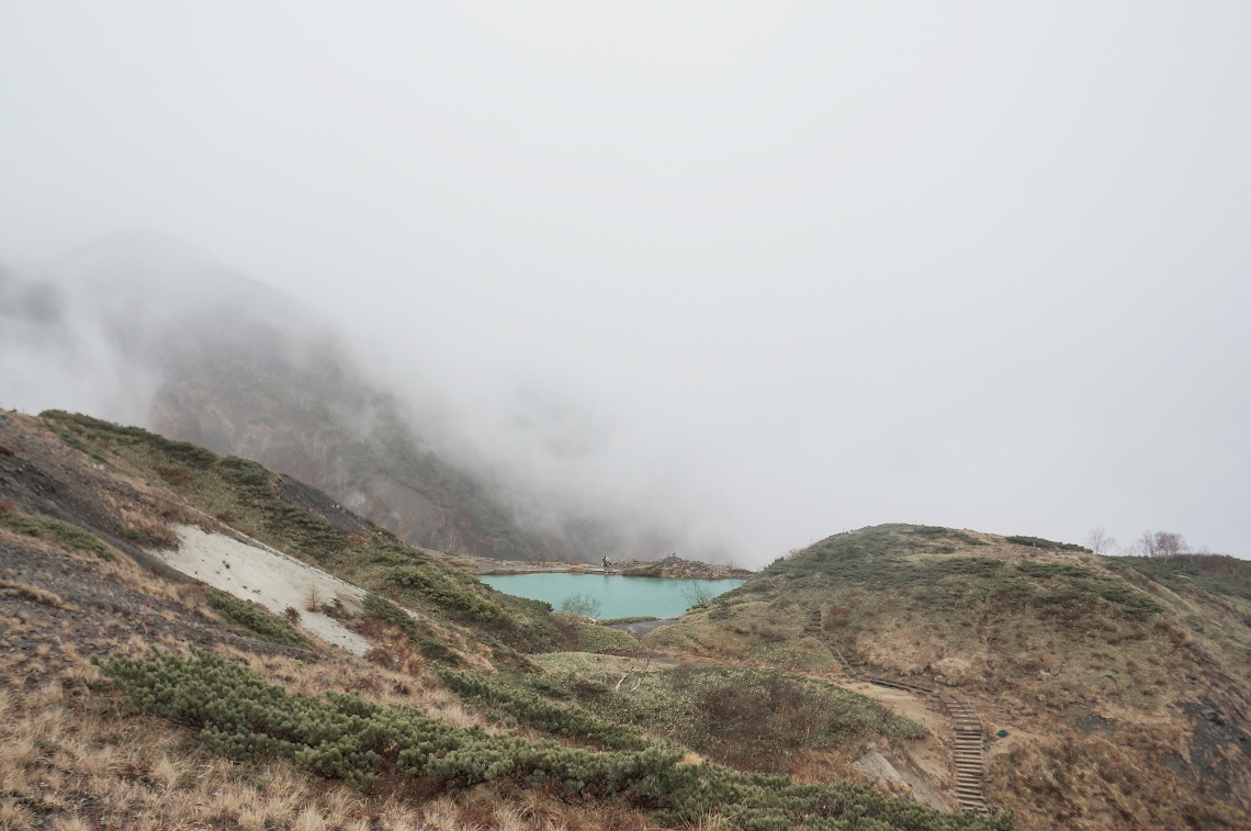 Happo-ike Pond.
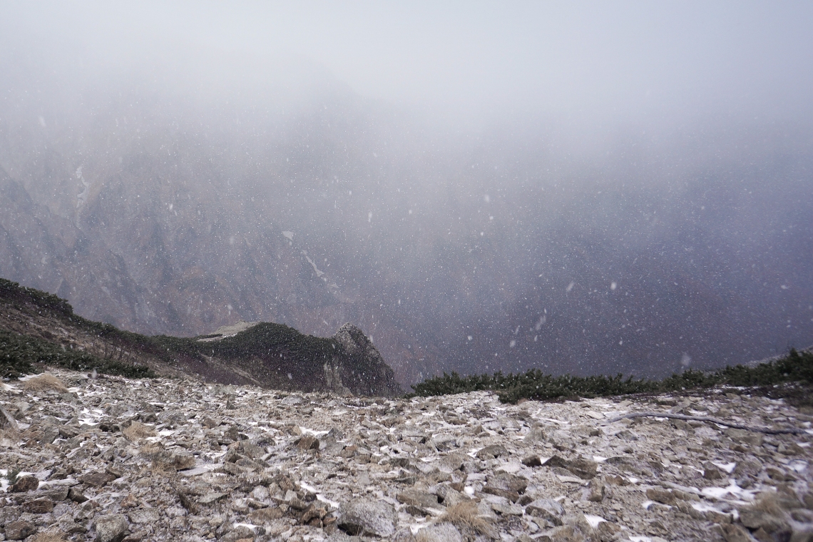
No sooner than I’d left the pond behind, sleet started to blow in from the south. The ice crystals were tiny but solid, and the wind was strong. I put on my jacket hood to reduce the sting. on my face. A few minutes later, the sleet turned to a proper snow storm. It was as though the mountain had decided that the pond was a far as it wanted anyone to go. By that time and from that point up, I didn’t expect to see anyone else up there. The last chair lift down for the season was at around 4pm, and none of the people I’d seen looked like they were up for a thousand meter slog down the wet ski runs. That sort of thing would be the stuff of fools. Or a fool.
The mountain began to feel more and more wild, the higher I plodded. As the snow continued to blow across, tree branches slowly turned white, as did the path. Every once in a while the clouds cleared just enough to tease views of the ridge higher up, but never enough to reveal the summit. I could never see more than a blurry grey that was slightly darker that all the other grey: hints that the ridge just kept going up and up.
An hour or so up from the pond, I saw some bird tracks on the fresh snow. Using my superior tracking skills, I followed them up the path, straight to a spotty bird that was sitting in plain sight about three metres off the trail.
It looked like some sort of grouse and sat on a bush staring at me curiously for a bit. It kindly posed for a photo, then flew off into the clouds.
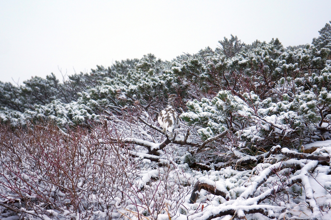
I passed a little group of the birds a little higher up, where there was more snow, stronger wind and thicker clouds. It was also growing darker. The birds huddled quietly together against the wind as I passed. I strained to try and make out a peak of some sort in the distance, but it was hard to tell what was mountain and what was cloud. Any features on the ridge were smoothed over by the greyness, making even near bumps look a long way away and impossibly high.
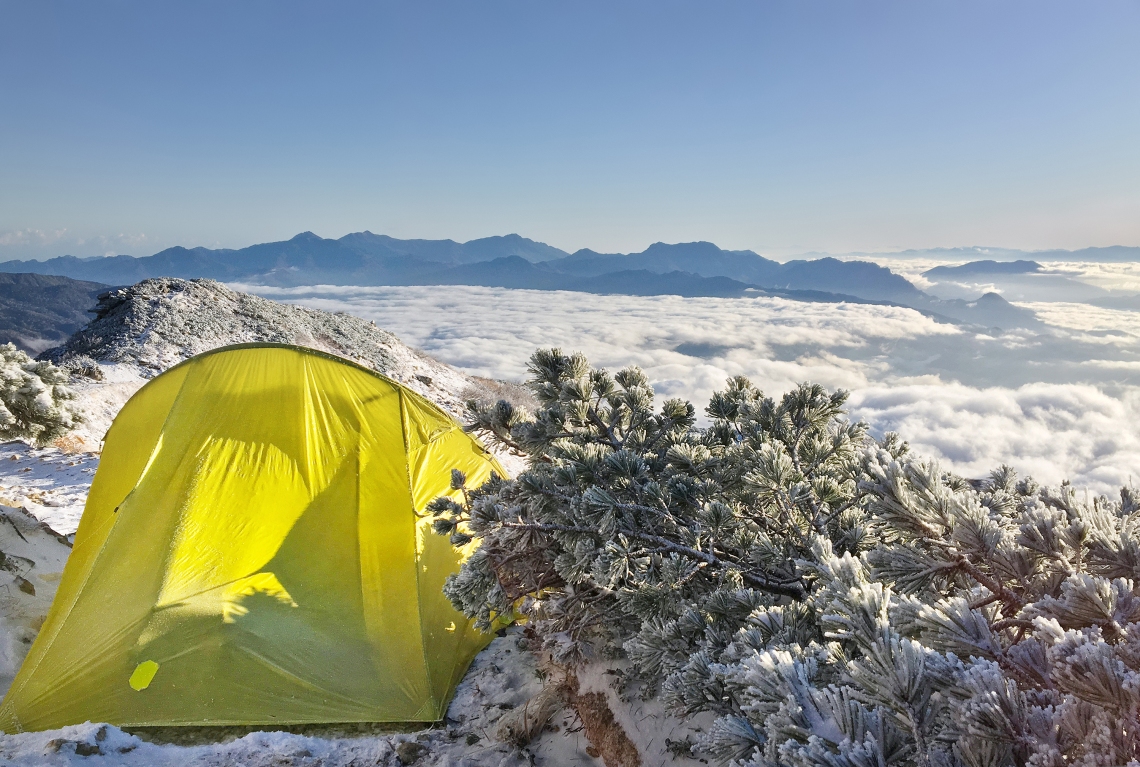
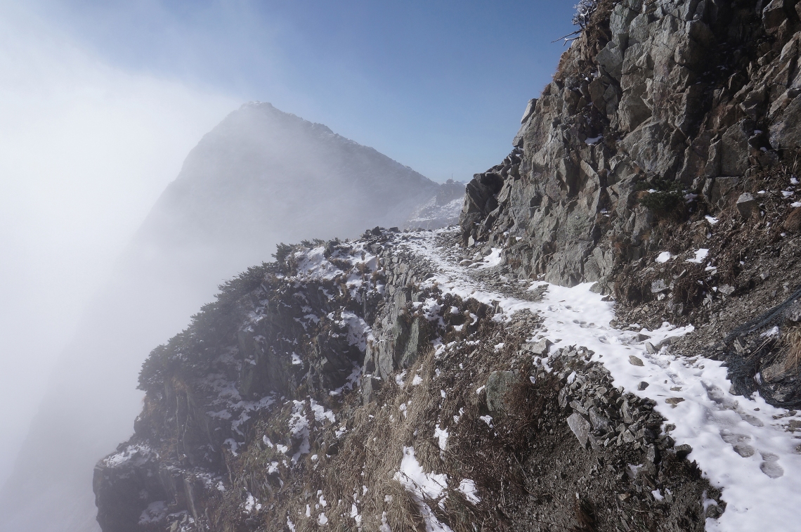
At around 5:30, it started snowing more heavily again and the night started to close in. I pressed on, until finally coming to a fence across the path, with a sign. One branch of the path continued on the other side of it, while another climbed steeply up and to the right. My GPS showed the summit lodge to be about half an hour away, following the right path. It was getting too dark to walk on an unfamiliar ridge at night, especially with a snowy track and cliffs around. I climbed over the fence to see if there were any flat spots large enough to put up the tent a bit farther along. A little way down there was a small wooden bridge breaching a gap the path. It looked like something you might see in the American Rockies: a rail bridge leading into a mine shaft, or an old war relic in the Italian Dolomites. It made the trail look a lot more foreboding than it was, though I couldn’t quite work out why. The drop wasn’t vertical, but about 70 degrees, and just kept going and going with no bottom in sight. With the help of a chain attached to the cliff, I shuffled slowly across, kicking snow aside to make it a little less slippery on the way back in the morning.
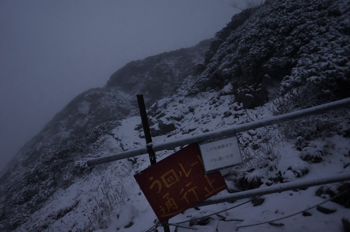
Around the corner was a perfect little spot, with just enough room for the tent. I unpacked it as fast as I could to try and stop snow getting into everything, which proved futile, and put on my headlamp. I always try to avoid camping on a path, but I was pretty confident that this one wouldn’t be seeing any early morning hikers.
By around seven I was all layered up and inside the sleeping bag. The sound of gently falling snow landing on the tent would have made for a nice way to fall asleep, had it not been an insanely cold night. It takes a lot of cold to get through the tent, mat, sleeping bag, sleeping bag liner and about five layers of warm clothes. The forecast had been for -9 or 10C at night and normally I stay toasty down to about -15, which made me wonder if it was actually much colder. The mountain weather wasn’t exactly sticking to meteorological script, which had predicted good sunny times.
Day 2
Woken by my watch alarm at 5:30. It was still dark and freezing, and a light wind tugged at the tent lines. I was in no hurry to get outside and decided to wait for things to warm up a bit first. At around six, sunlight hit the tent, turning it from murky mustard-grey to an intense fluro yellow. The sun didn’t have to knock twice. I was straight out of the sleeping bag, stripping down layers and outside to see how the day was looking.
It was looking glorious. Barely a cloud above, and a sea of white and blue below. Even with the bite of the cold breeze, I felt myself warming up in the sun’s first rays. I set about packing up, knocked back some energy goop and soft lollies and got going.
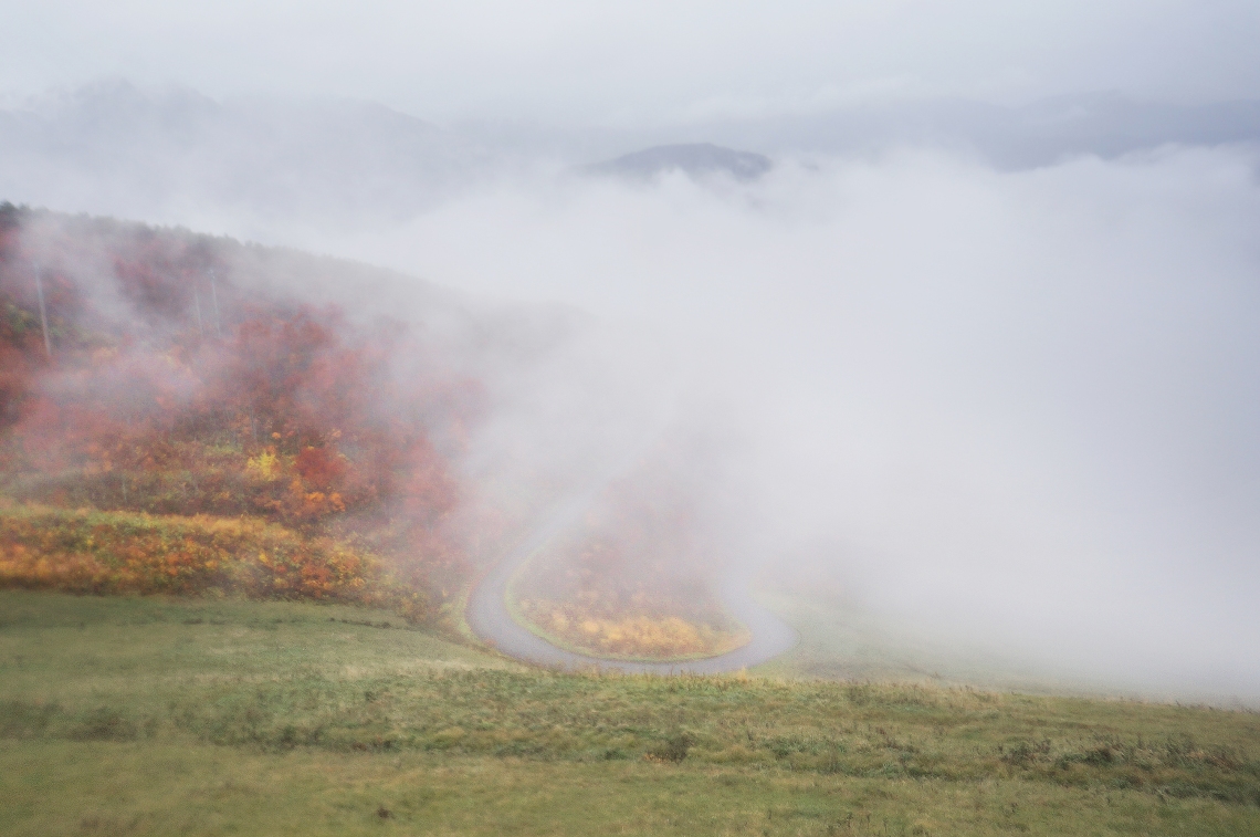
The first thing I wanted to see was where this closed track went. It was unusual that it wound around the eastern face of the mountain. All the mountains in that range slope from west to east, with steep eastern faces. Subsequently, nearly all the north-south paths up there run across the western sides of the summit ridges.
A little beyond where I’d camped, a small landslide had come down over the track. It was only a couple of metres wide, but enough to make a crossing dicey. In the middle of the slip and on the edge, was one flat rock covered in snow. I scraped the snow off using my walking pole and gave the rock a few pokes to see if it was stable. It didn’t move, but I couldn’t get enough force going with the pole to really put it to the test. There were two ways to cross – run and jump the full thing Indiana Jones style, or step slowly and carefully and use the rock and hope it was stable enough to take my weight. If either approach failed, it would end with a gold medal-worthy cartwheel set down the slope and disappearance into the clouds.
The issue with the rock was that there was no way to test it without committing to stepping on it. It was too far away to give it a good push with my boot while standing still. Even just trying, I could feel the mushy soil giving way under my back foot. All the rain from Typhoon Hagibis, together with the melt from the first snow, had softened the ground. If it slid away under either foot during the crossing, it’d all end badly. There was also nothing to grab onto if the rock gave way. I pictured the thing falling away beneath my boot as I tried to launch myself off it to get to the other side, and the panic as we both went over the edge. The Indiana Jones technique might work, but if the mushy ground gave as I went for the jump, that wouldn’t end much better. I turned back.
 Slipping not recommended.
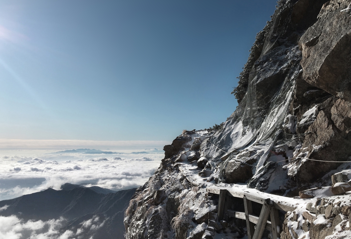
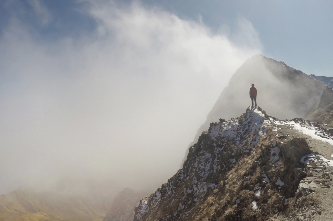
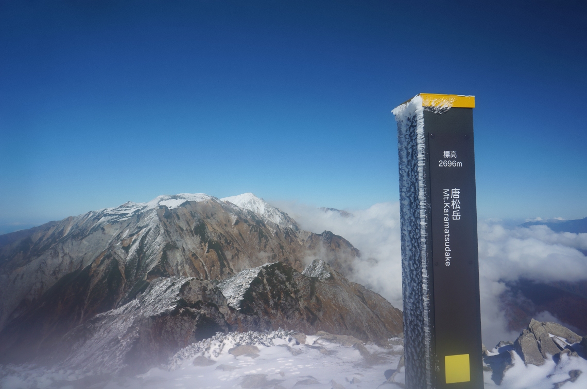
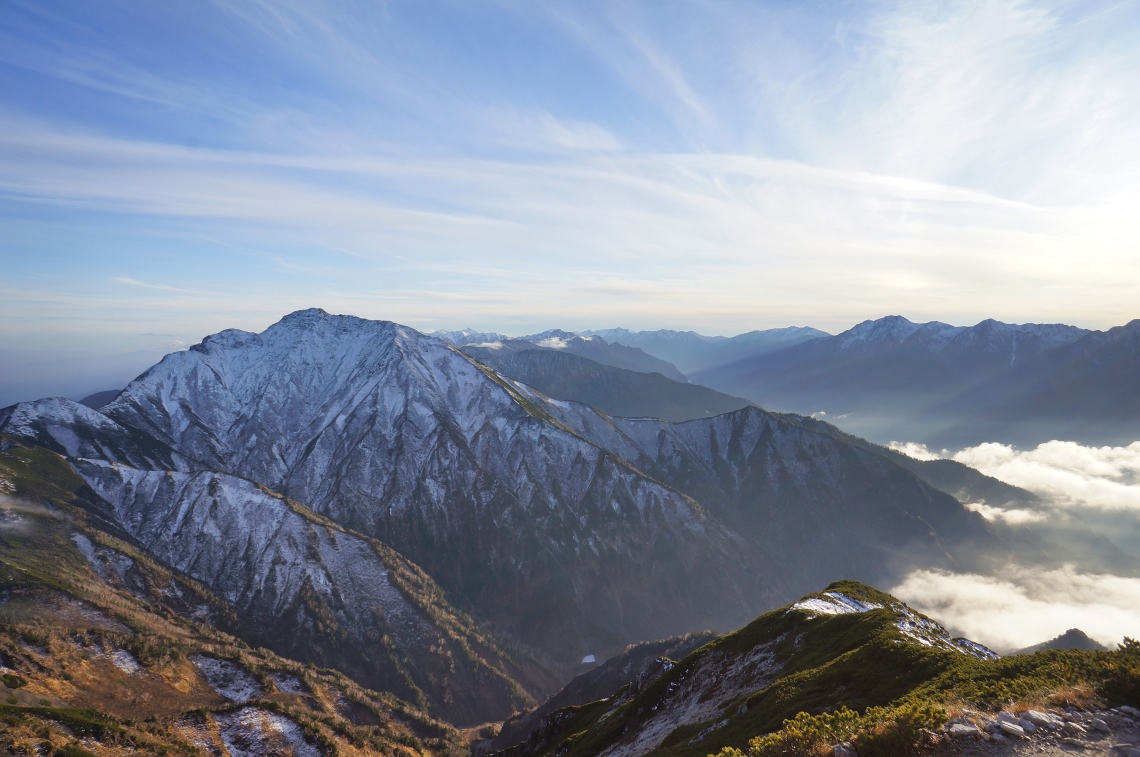
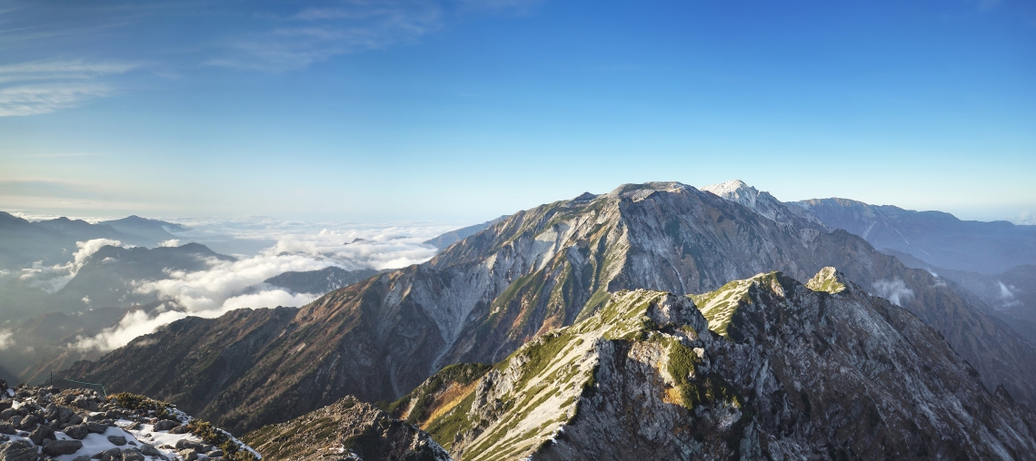
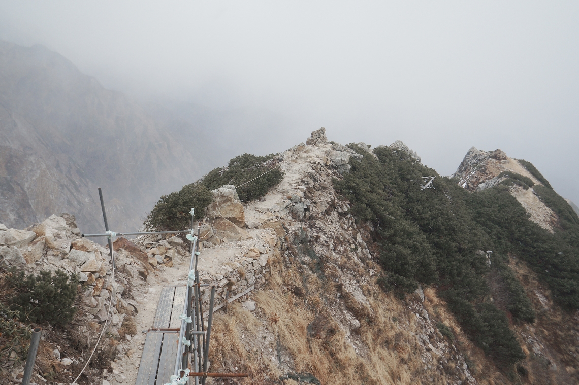
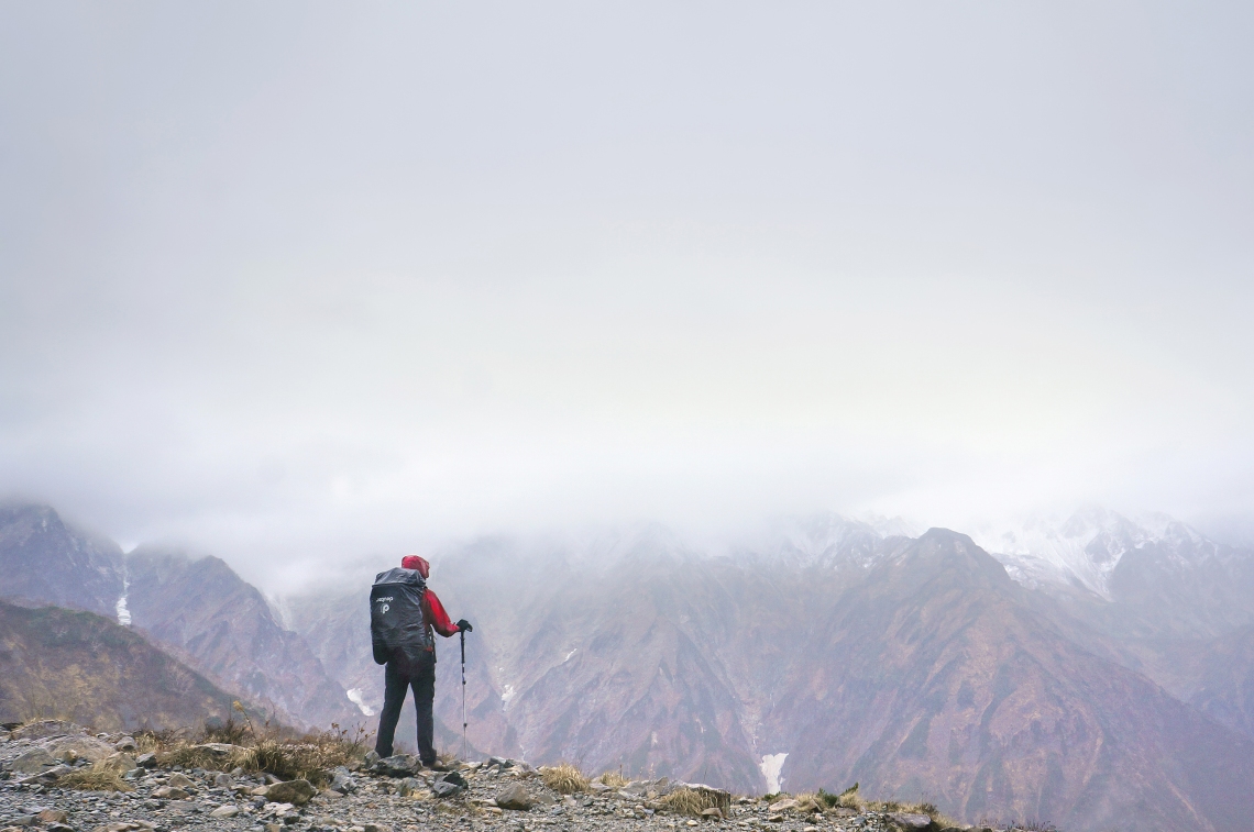
It was only a few minutes back over the wooden bridge to the fence. Then it was up the steep steps I’d passed the previous night, and onto the top of the ridge. Ankle-deep snow had collected on the steps but a rail made it easy to heave myself up. The ridge was about a metre wide at some points, with scaffolding and planks to help in a few places. Off to the right was a spectacular panorama of the Hakuba mountains: Karamatsudake, The jagged humps of Mts Kaerezu 1, 2 and 3, flat-topped Mt Tengunokashira, then farther out to the pointed tops of Hakubayarigadake and Shiroumadake. From that face-on angle, the whole range looked like some impenetrable rock fortress.
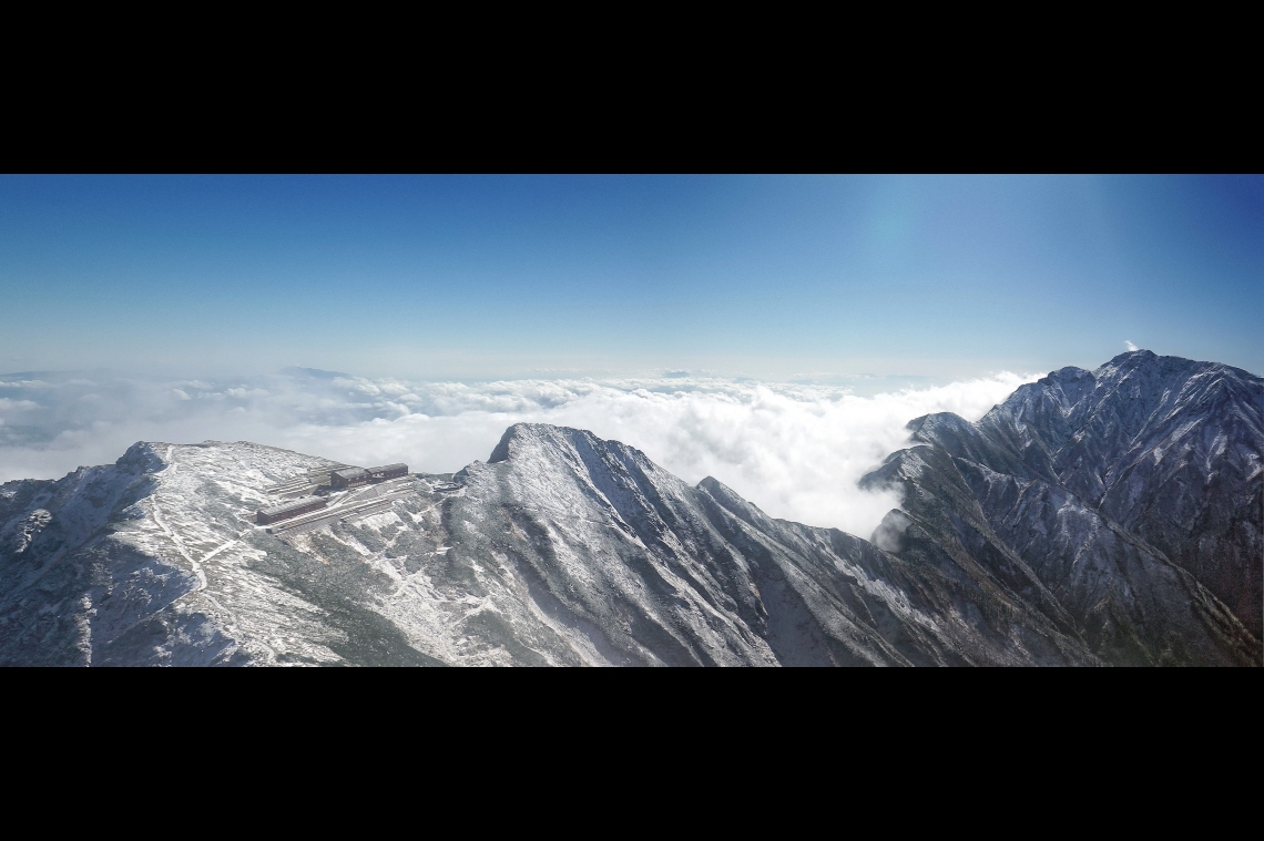
Only half an hour later after heading off, I found myself at the top of the ridge, looking down at the Karamatsudake summit hut. Behind it was a grand vista of the Northern Alps, Karamatsudake summit, and the other mountains in the range. I went down for a look.
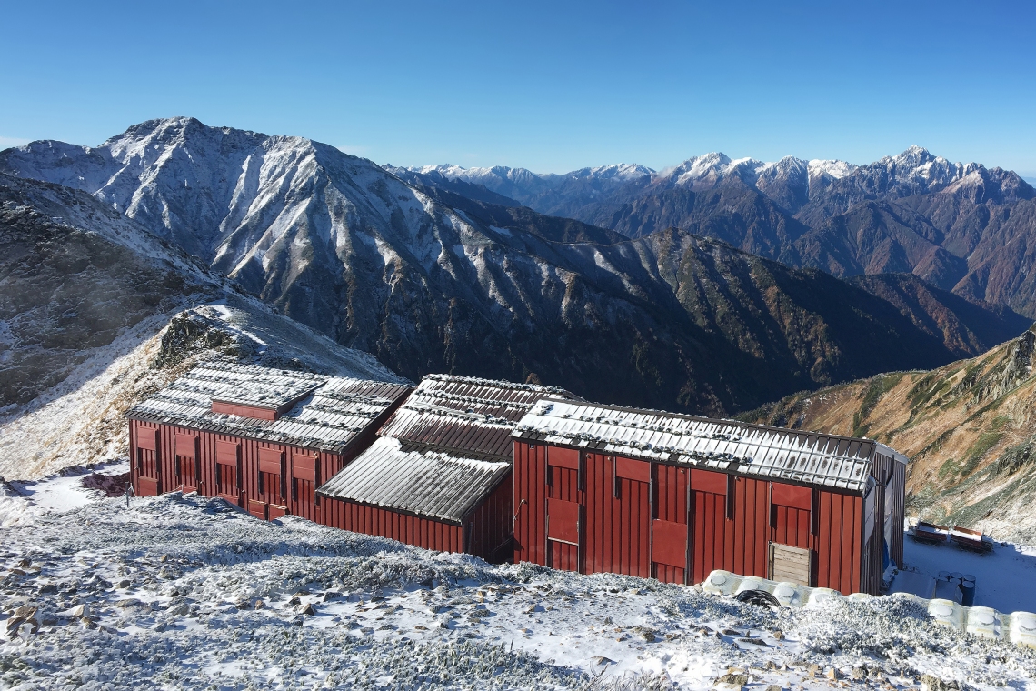
The two main buildings made a nice wind break, so I found a flat spot between them and got to emptying out my backpack. The tent and sleeping bag were both wet so I hung the tent off a nearby rock wall and spread the sleeping bag out on the ground to dry. Then I set up my stove to make breakfast and decide on where to head next. The sun was melting the previous day’s snow fast, with clumps falling off the roof every few seconds. It felt more like spring than autumn.
The summit looked to be a 20 minute hike away, so after filling up, I left all my stuff at the hut and headed up for a look. The snow was much deeper between the lodge and the start of the climb up to the peak and made for some nice crunchy walking. It also made me wonder how deep it must have been on the higher peaks along the range.
 The Karamatsudake summit ridge.
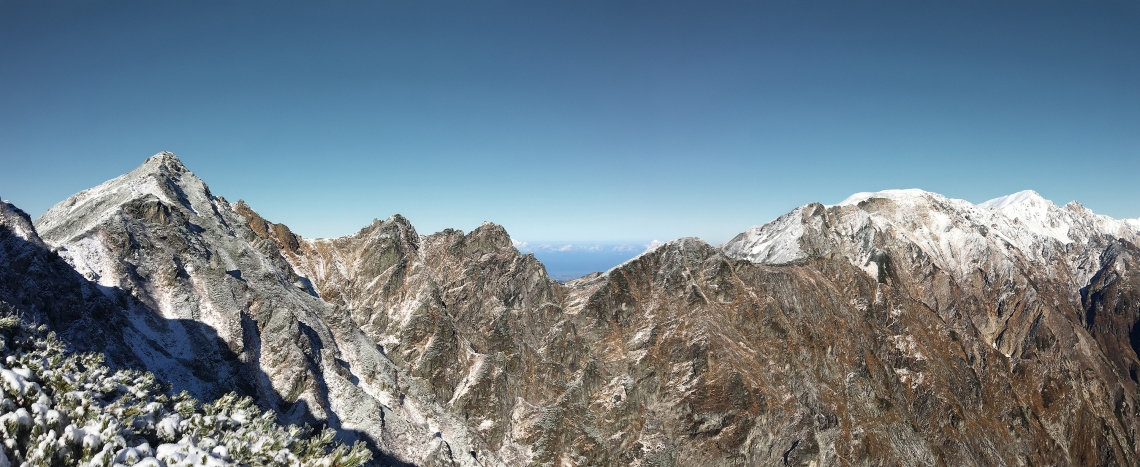
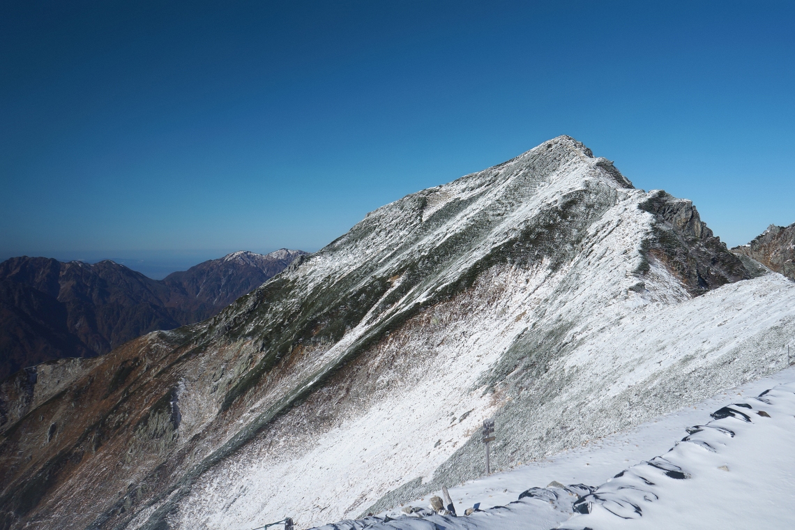
Up on top, the views were spectacular. A proper 360 degree panorama of the mountains stretched out on every side. There were tracks from two animals up there as well. One looked like those of a large rabbit or small antelope, while the others were more like cat prints, complete with pointy claws. I wondered if some animal kingdom fight club type drama had unfolded up there earlier in the morning.
 Looking back to the hut and Mt Goryu.
 The view to the north as the camera lens fogged up.
Right at the top of the small summit area was a great little flat spot, about three by three metres square. It was a perfect place to spend the sunset and night. At least, if the weather stayed decent.
My original plan, pending the weather, was to spend a couple of days crossing the mountains and head back down to Hakuba via the Mt Shirouma ice field. But I wasn’t counting on such a big snow dump, and both Shirouma and Hakubadake already looked like they had a lot on top. I had no idea what it would be like climbing up some of those steep ridges in the snow, or whether every steep bit had chains. It would only take one tiny section with snow and no chains, and like the landslide bit the day before, it would be the end of the road. And even if the snow melted, the mushy ground was still a concern. It was tempting though. I had a few days off work and plenty of food. But if I got halfway across and another snow storm blew in, it would be a nasty place to be stuck. I decided to spend the night up on the Karamatsudake summit and see what the weather had planned.
 Mt Goryu.
It was chillier up on top, so I headed back down to the protection of the hut, where I spent some time exploring and taking photos. Around the back of the buildings were a path leading off across the steep eastern face. Presumably it was the other end of the one I’d tried to take earlier in the morning. I followed it for a bit and enjoyed some beaut views across the sea of clouds over Hakuba, as well as the terrain dropping away down the mountainside.
 Precipitous bit of the path behind the hut.
 Beautiful colours on the mountainside.
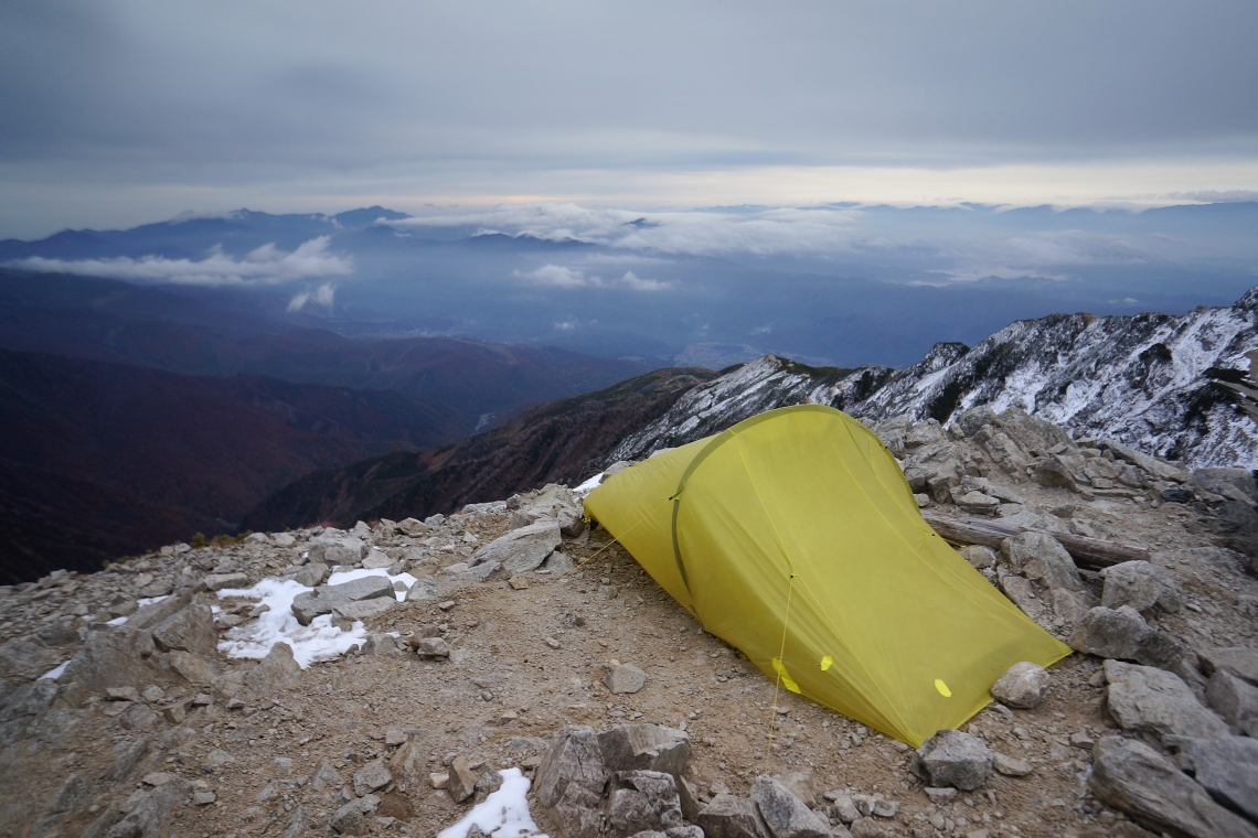
By around 1pm, the sun had done a great job of drying everything off. I packed up and plodded back up to the summit. The wind was still light and setting up the tent was easy. I didn’t want to take any chances, and piled a few of the large summit rocks around the corners of the tent and onto the pegs. Once the guy lines were all taught and the whole thing secured, I crawled inside for a nap. The afternoon sunlight quickly warmed up the air inside and with one of the tent panels flapping gently in the breeze, I dozed off for a bit.
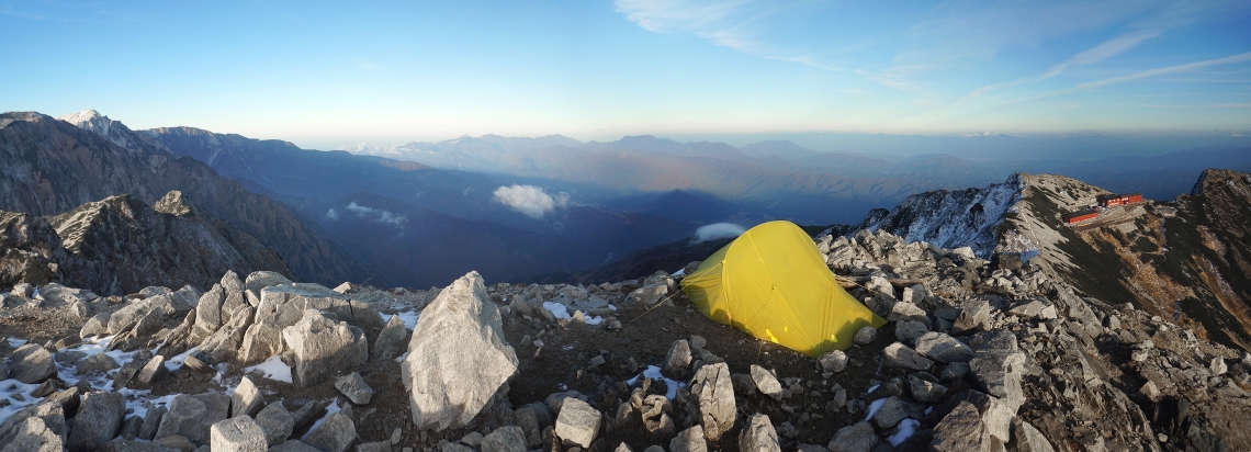
By four, the sun was low over the Alps and the view had become something a bit special. The wind died away to almost nothing, and the huge mountain panorama was silent and still. To the south, a few wispy clouds crept over the saddle between the hut and Mt Goryu. West, golden rays of sunshine cut through the mountains, lighting up a sea of clouds below. Northward, the Hakuba mountains were vivid greys and greens, one half in light and the other in deep shadow. And east, the shadow of Karamatsudake stretched out across the Hakuba valley.
As the sun continued to sink, the colours became more and more vivid. In the last twenty or so minutes of sunshine, the rocks on the summit around me turned a vibrant pinkish-red. Orange rays of light blazed down into the valley between Karamatsudake and the Alps. The landscape out to the east turned a striking rich blue against the pink horizon. At that moment, I didn’t care if I got across the mountains or not. It was worth the trip just for that one summit view. I had my earphones in and just sort of zoned out and let the atmosphere of it all carry me away.
As the sun descended into the clouds, the temperature plummeted. It went from comfortable, to tolerable, to drop-what-you’re-doing-and-get-into-the-frigigng-tent, in a matter of minutes. I layered up and ate dinner inside. Then it was into the sleeping bag. Despite it being even colder than the previous night, I had a toasty sleep. Scraping away the snow on the flat area before putting up the tent probably had a lot to do with it.
Day 3
Again, my alarm went off at 5:30 and again I lay waiting for some sunshine before crawling out into the cold. This time, it didn’t come, and an hour passed before I reluctantly dragged myself out of the tent. The surrounding mountains were all still visible, but the day was looking pretty grey and grim. I set up the stove and decided to wait one more hour before choosing whether to try and get across to Mt Shirouma or head back down.
By the time I’d packed up, clouds had begun drifting in from the Hakuba valley. It didn’t take long for the tops of most of the mountains to disappear. I checked the weather forecast for the next two days: “Some clouds.” When the forecast was for clear skies, there was a snowstorm. I figured that “some clouds” must then at the very least, mean multiple lightning strikes and a meteor impact or two. I headed back down to the hut.
After a quick snack of energy goop and a couple of last photos of the mountains, I began the long plod down.
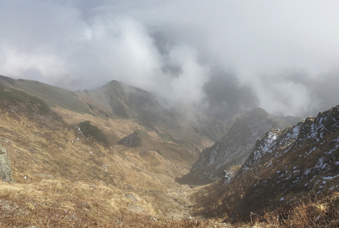
Within half an hour of leaving the hut area, the clouds moved across, bringing another snow storm. This time it was accompanied by stronger wind, and the tiny ice crystals stung hard. The views disappeared and with no reason to hang about, I walked fast. It snowed hard and furious for about ten minutes, then stopped. The clouds swirled around and every once in a while the lower slopes of the mountains opposite appeared, grey and ominous.
It only took two hours to get back to the pond. After a quick photo stop I continued on and within half an hour more I was back at the high chairlift station.
I had a quick break here, but the drizzle had started up again and I wasted no time in heading down to the lower station. On the way up I’d suspected that I’d have to walk all the way down the ski slopes. They were black and red runs and I wasn’t looking forward to doing them in the wet, but I noticed a nice nature path that connected the two chairlift stations and it made for much easier walking. Some maintenance workers were busy on the chairlift towers that ran parallel to the path.
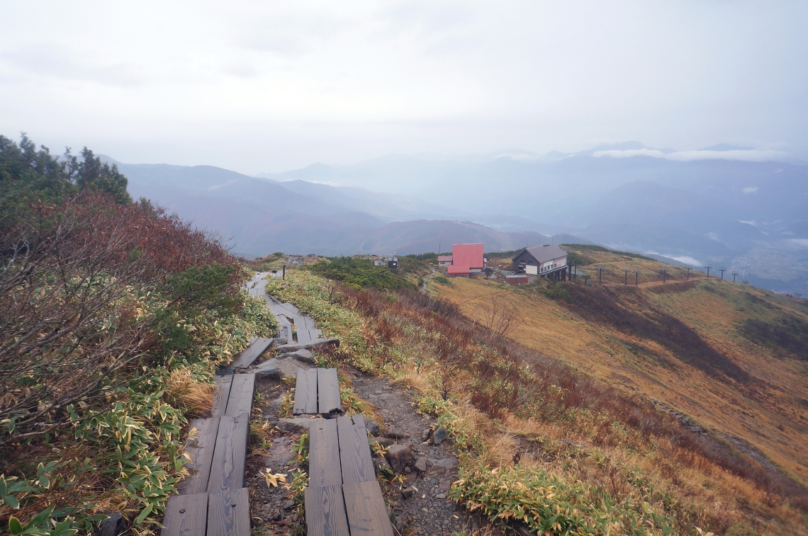
I reached the lower station at around 10am and took 20 minutes to rest and snack under the balcony of one of the chairlift buildings. I had two choices from here – continue down the ski run to the top of the gondola, or take a service road. The ski run was a sure bet but steep and probably slippery. The road was easier but I didn’t know exactly where it came out at the bottom. I decided on the road, just because it wound its way down through pleasant green meadows and looked like a nice walk.
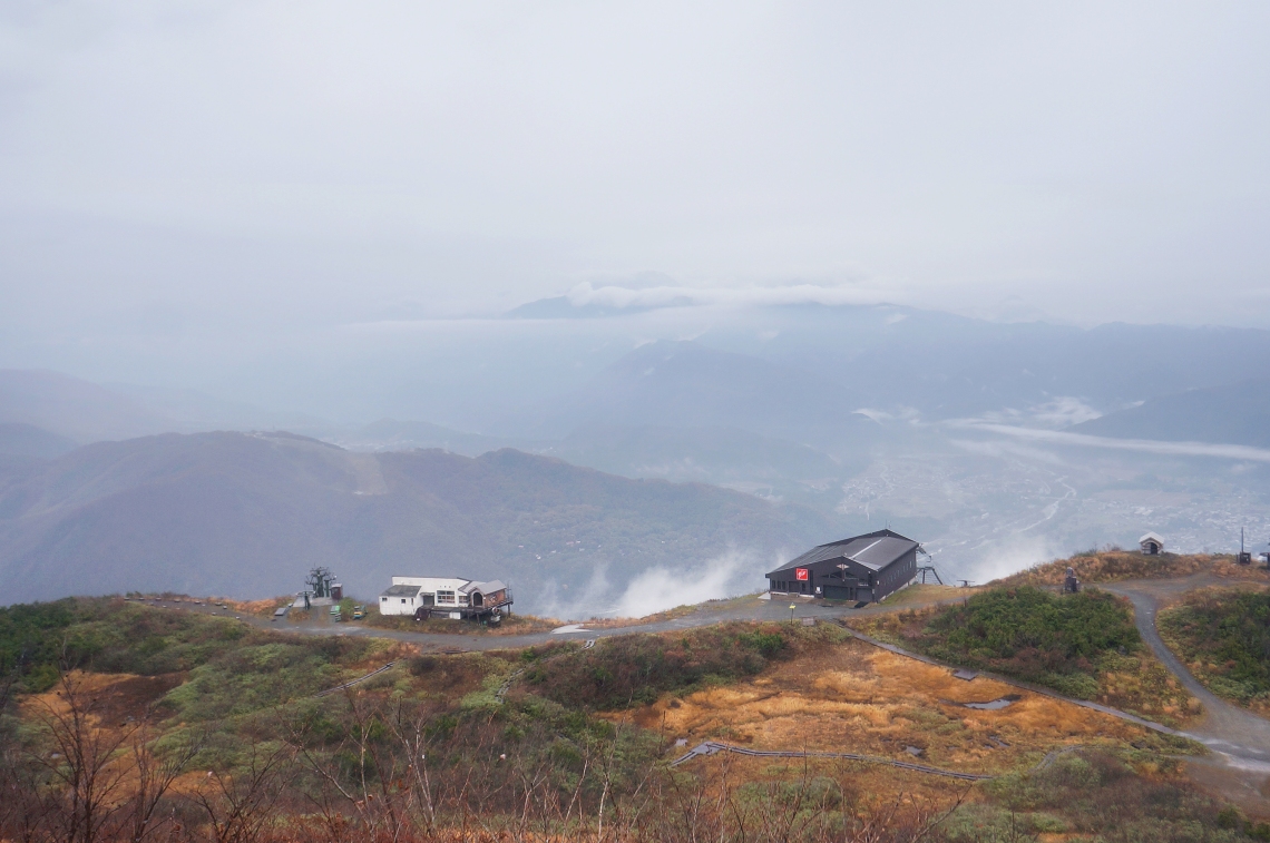
The first stretch was probably the steepest road I’ve ever seen. It must have been nearly 30 degrees and even walking down it in the rain was slippery. It went straight over the edge and down the hill, only levelling out a couple of hundred metres later. It then turned off to the left to meander down and across the mountainside in long loops. Happo and the gondola were on the right, so I walked a little way across a meadow to see if I could get across. The gondola had its own dirt service road that I hadn’t noticed on the ride up. There was dense scrub between the two ski runs and I didn’t feel like a bush bash, so I continued on down the paved road instead.
Instead of walking every long loop of road around the mountain contours, I cut down from section to section using the ski runs. Some of these were incredibly beautiful, with chairlifts disappearing into the clouds above, green grass and autumnal colours on the surrounding slopes. The going was steep and slow, but I really enjoyed this part of the hike all the same. Every once in a while, headlights would cut through the clouds as a service vehicle passed up or down along the road.
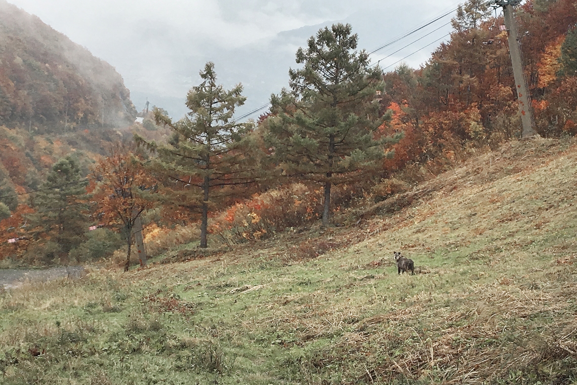
Down near the bottom of one run, where the road looped around a small chalet, I heard a loud swishy snort. About thirty meters off across the slope was a serow. It was an odd-looking one as far as serows went, with an old man beard and big white sideburns. It looked like the type that might put the garden hose on you if you strayed a bit too close to its azaleas. It stared, unmoving and wide-eyed as I passed. A second one stood staring from a little farther off up the slope.
At the chalet, I reached an intersection. One road lead off to the north and well away from Happo. Another headed back to the south. It was all steep forest around and below, with no more ski runs to follow. I decided to do a map check and switched on my phone. Despite hardly being used, the battery was down to 11 percent. Still, more than enough to see where I was. I didn’t have a route to follow in my GPS, as I hadn’t decided on an exact route back down.
Within an instant of turning on my data, a flood of messages and notifications flashed up, one after the other. I brought up the map app, but because of all the notifications, it couldn’t load the map. I watched helplessly as the battery charge dropped from 11 to 10 to 9 and 8 and 7 percent as notification after damned notification came up. Emails. Messages. Spam mail from a site I’d ordered a pizza from eight years ago. You gotta be kidding me. It was a torrent of battery-depleting data. Finally some lines appeared on the map. But it was a scrambled mess and none of them looked anything like where I was. Random place names appeared, then disappeared, none familiar, and at last, for about three seconds, I saw some roads that looked like they branched out from an intersection. One headed off left into the mountains, one looked like a dead end to the right, and then the map went blank again before I could see where the third ended up. Meanwhile, the phone had no problem continuing to download all the message notifications with the speed of a Space-X server. Then it died.
The road going left was pointless. So was the dead end. There was nothing down there but steep forested slopes. I headed off to the right. 20 or so minutes later, the road ended not far from a round building and the top of a very steep chairlift corridor between trees. There was thick, tall grass beneath the lift towers and it looked like a terrible way to have to get down. I looked around. I was at the foot of another ski run. But I wanted to go down, not up. There must be some way they all connected. I walked up the run for a little bit to see what I could see.
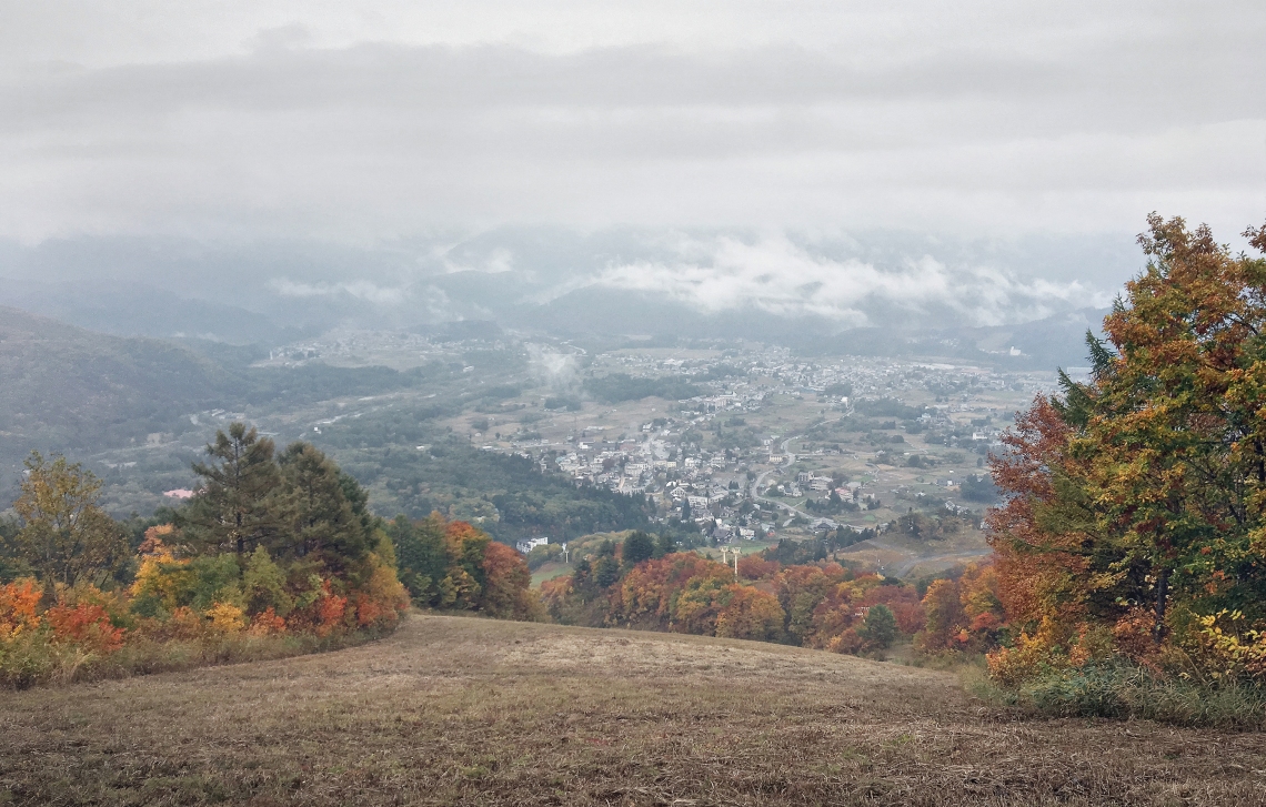
Not far south, was a small dirt road and a tunnel that ran under a second ski slope. It had to lead somewhere. I followed it, and was pleased to find that I’d popped out onto a small plateau near the top of yet another run. I felt like I was in a real world game of snakes and ladders; heading up, down and across the mountainside as I tried to find my way back. A very picturesque game of snakes and ladders. I walked over to the edge. The run snaked this way and that, all the way down to Happo. It was lined with the reds and yellows of autumn and gave superb views out across the town of Hakuba. I snapped a photo and headed down once more.
It was steep but easy enough, and before too long I spotted the gondola towers and the Gondola Hotel at the bottom. About two thirds of the way down, a service road branched off to the right, taking a detour through the forest before reconnecting with the run a little farther down. I decided to walk it just to be able to take a stroll through the trees, and was rewarded with a pleasant little corridor of colours.
At just after 1pm, I left the slope and stepped onto the main road. I’d come down a couple of hundred metres above the gondola building and strolled down to it in light drizzle. There was hardly anyone about and the walk back to the Happo Bus Terminal was a peaceful way to end things.
A change of clothes and some deodorant later, I went in and bought a bus ticket for the 3:15pm bus back to the Shinjuku terminal. Then it was off to one of the few small restaurants in town that was open, for some warmth and a bowl of udon noodles.
___________________________
Grandeur: 9
General Beauty: 9
Peacefulness: 8.5
Difficulty: 4
Hikeography Rating: 9/10
___________________________
Useful links:
Hakone forecast:
https://www.mountain-forecast.com/peaks/Happo-One-and-Karamatsu-Dake/forecasts/2696
Shinjuku-Hakuba bus timetable:
https://www.alpico.co.jp/en/timetable/hakuba/r-shinjuku-hakuba/
Photos of some of my other outdoor adventures:
https://www.instagram.com/gregsoutdoorstuff/
My other Japan blog:
https://wordpress.com/view/undiscoveredtokyo.wordpress.com
